Both trips started as itinerary documents, and they were good documents. The trouble with an itinerary in prose is that every drive time is a number inside a sentence, and they all look alike. “80 km, 1 h 45 min” and “80 km, 55 min” read the same. On a terrain map you can see the mountain in the way.
Iceland first
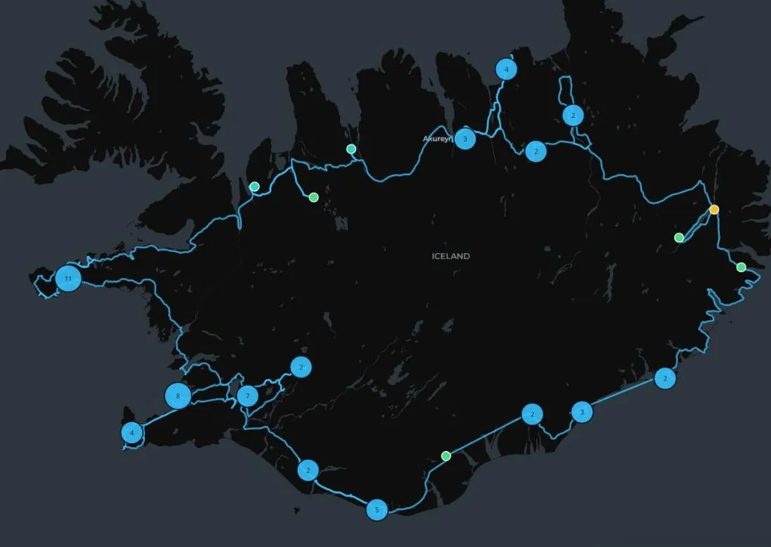
The first map was for a ring-road trip in June 2026, for a friend’s 40th: 64 stops (9 of them optional), 63 legs, eleven days. Road geometry is fetched ahead of time from OpenRouteService, throttled to fit the free tier’s 40 requests a minute, with a resume cache because it will get interrupted. Photos come from Wikimedia Commons with credits, and a script checks they still exist. The map also marks the fuel gaps. Vík to Höfn is about 270 km.
The first two legs had to come from a different router, because ORS couldn’t route them, so regenerating the whole file quietly undoes them. That’s written down now, in capitals.
It’s at iceland-beta.vercel.app.
Costa Rica, stricter
The second map was built to send to everyone coming while the plan was still open: nine days, a 517 km loop at an average of about 46 km/h, three basecamps, 28 stops.
- A stop is either on the main route or a side trip from a basecamp, never both, and the schema enforces it.
- Drive tracks are worked out from the stops, so the two can’t drift apart.
- Detour costs come from the routing data, not from me. The catamaran adds 26 minutes. Dino Land adds 150.
- On days when the group splits up, both paths are drawn side by side. The day filter dims stops instead of hiding them, so the path not taken is still on the map.
- The whole view lives in the URL. Send someone
?day=3and they see day 3. - There are no API keys anywhere: OSRM for routing, CARTO for tiles, and hillshade from AWS’s open elevation tiles.
What fought back
- The geocoder put Manuel Antonio National Park 39 km from where it is, and the router cheerfully drew a road to it. Side trips now have to be within 25 km of their basecamp, and no point may be moved more than 500 m to reach a road. That second rule immediately caught a Tárcoles pin 660 m from the nearest road.
- Carara. Both geocoder answers passed every check, and neither was the visitor center. A few points are still marked unverified.
- Cluster bubbles showed numbers, and a 6 on a trip map reads as “day 6”. They’re named basecamp hubs now: “Arenal · 7 stops”.
- Dropping a detour couldn’t be undone. It has a Restore button.
- Confirmation numbers don’t belong anywhere near a shared link, so the schema fails the build if one turns up. The booking checklist keeps its ticks in the browser on purpose.
Status
Iceland happened. Costa Rica leaves February 26, 2027, and a few coordinates still need checking before then.